Introduction:
In the previous post I explored the capabilities of the Pix4D Mapper software and how it can be used to better analyze data. In this lab, we took the same set of data and included ground control point data in order to better understand how Pix4D implements GCPs to make GIS more accurate. Ground control points are points with a known location that are used to increase the global accuracy by ensuring the points on the map correspond with an accurate GPS coordinate.
Objectives:
#1: To import ground control coordinate data into Pix4D
#2: To understand how to set the coordinate system of the GCP data
#3: To adjust your data in Pix4D using GCP coordinate data
#4: To better understand and compare differences between corrected and non-corrected data
Methods/Assignment:
For this lab, we used the same set of images and data that we used in the previous post. However, in this case we excluded the thermal imagery and just used the images from the Mavic 2 Pro, A6000, and XT2 RGB. Similar to before, we loaded the images into the Pix4D software and ensured the coordinate system was correct. For this assignment, we were to ensure that this time the output coordinate system was set to the same one as the GCP data. In this case, the images were in WGS84 while the GCP data was in NAD83. I initially had some issues with this because I failed to change the output coordinate system to NAD83 which, in return, gave me results that were far off from what they should have been.
After loading in the images and the GCP data using the GCP/MTP manager, including verifying that the coordinate system was correct, (Figure.1) I began the initial processing step. For this assignment, initial processing was the only step that we completed but it is important to note that GCP data should be processed and verified after initial processing. The other 2 steps of the processing should be completed after all of the GCP data has been verified as accurate.
 |
| (Figure.1 GCP/MTP Manager) |
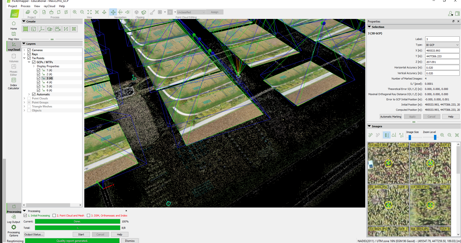
Once initial processing finished, the next step we took was mark each of the GCPs to their respective images. For this we used the rayCloudEditor to mark each one as accurately as we possibly could. This part involves clicking on a GCP and then zooming into the images that are closest and clicking the area closest to the circle. For each GCP, we ensure that 4 images were marked. (Figure.2) You can see the various symbols on each image below. The blue circle is the estimated location of the GCP. In order to accurately mark the GCP, we zoomed in as close as we could and clicked in the center of the blue circle.
 |
| (Figure.2 rayCloudEditor) |
Each GCP was marked with 4 images for each of the 3 data sets that we processed. Below are the results from each data set with their respective GCPs marked to images.
 |
| (Figure.3 Mavic 2 Pro) |
 |
| (Figure.4 Mavic 2 Pro) |
XT2 RGB
 |
| (Figure.5 XT2 RGB) |
 |
| (Figure.6 XT2 RGB) |
A6000
 |
| (Figure.7 A6000) |
 |
| (Figure.8 A6000) |
After all of the GCPs are marked it is important to reprocess all of the data. This can be achieved by clicking Process and then Reoptimize. This ensure that the quality report incorporates the accurate GCP data. The quality report is important to ensure all of the data is accurate before moving on to the next 2 steps in processing. For this lab, we took down some information from the quality reports such as absolute geolocation variance, ground control point details, and relative geolocation variance. (Figure.9 & 10) All of this information goes into detail on each of the ground control points to give a in depth understanding of their accuracy.
 |
| (Figure.9 Quality Report Overview) |
 |
| (Figure.10 Geolocation Details) |
Discussion:
Comments
Post a Comment